Demo without signing in
One real parcel in Antibes, from map to analysis.
This is how ParcelIQ works on one cadastral parcel in France, section CE, no. 0056. Every screenshot is from the app.
- Parcel
- Antibes, section CE, no. 0056
- Area
- 78,655 m²
- Source
- IGN API Carto PCI · Licence Ouverte
1
The parcel on the map
Parcels in Antibes are coloured by planning zone, so you see at a glance which parts of town share a zone. Select a parcel to open it.
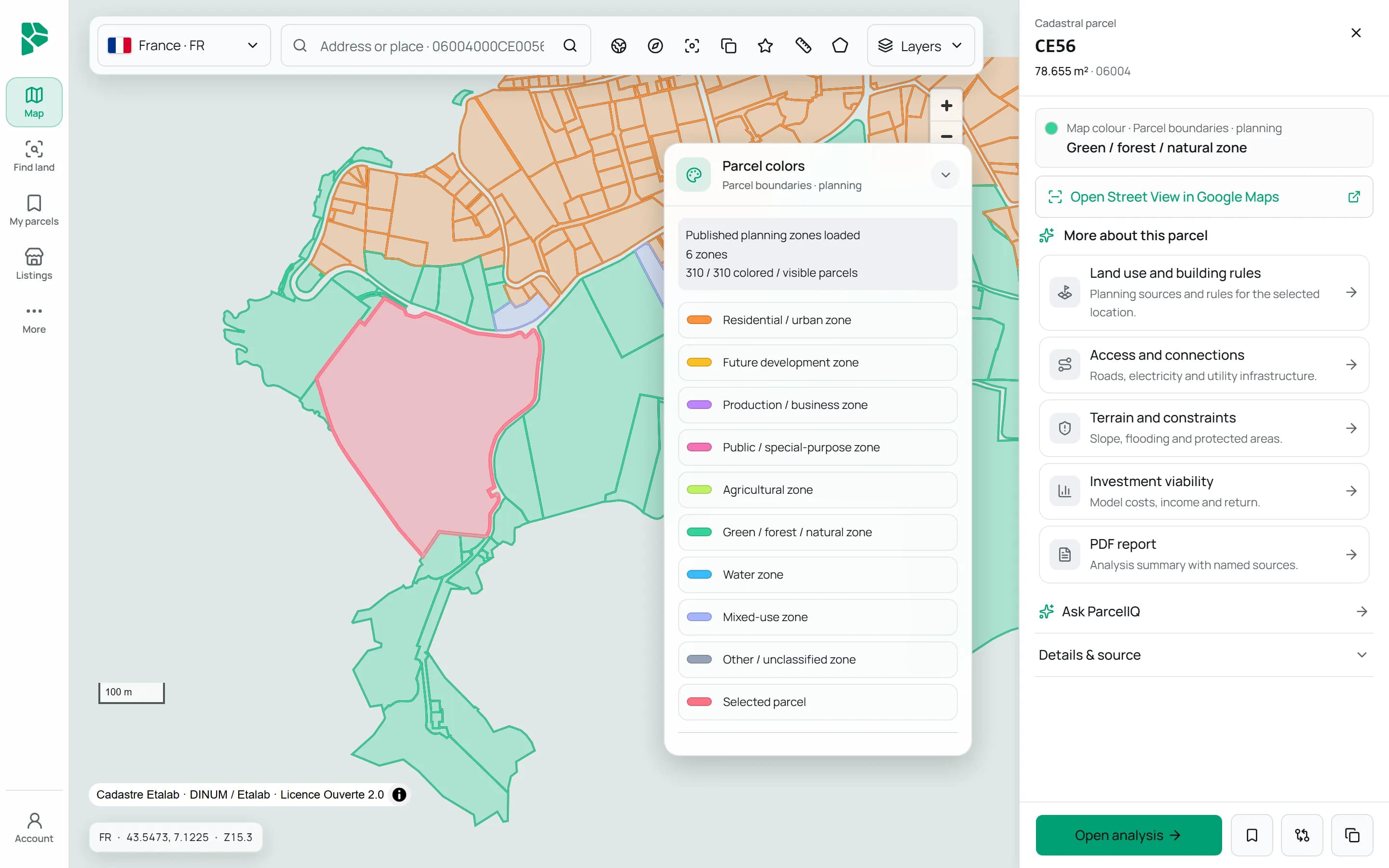
2
The free check
One click opens the parcel with the facts below, each with its source and date. The example parcel does not use up a free check.
Parcel reference and area
IGN API Carto PCI
Plan zone
The plan published for the commune (PLU)
Road
OpenStreetMap
Power line
OpenStreetMap
Water
OpenStreetMap
Natura 2000
European Environment Agency
Terrain and slope
Copernicus DEM
Solar yield
PVGIS, European Commission
Land cover
OpenStreetMap
Result on 2 November 2026: plan zone Na (PLU 06004_PLU_20251222), Natura 2000 site FR9301573, a mapped road 36 m and a power line 362 m away, about 27 m elevation, about 2° slope and about 1,525 kWh per kWp a year.
Buildability, ownership and grid capacity are not published in one form across Europe, so the map does not claim them.
3
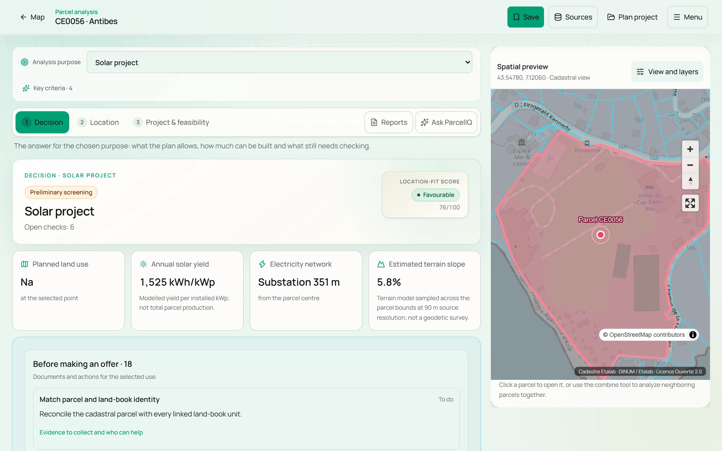
Parcel analysis
The full analysis puts the same parcel in the context of a project: here a solar project, with plan zone, solar yield, distance to a substation and slope.
4
Land search
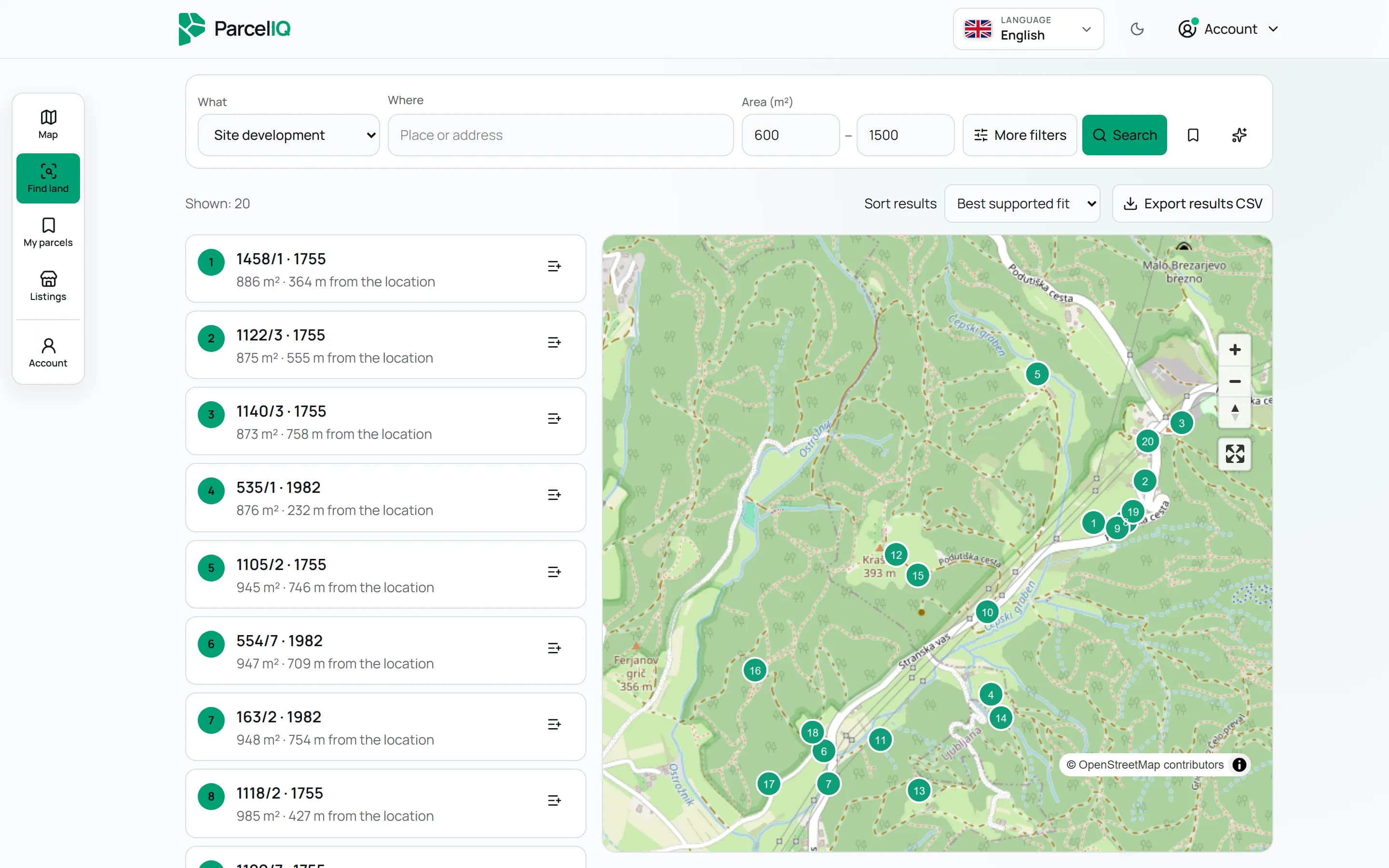
Search the other way round: pick a purpose, a place and a size, add criteria, and get parcels on a map.
- Criteria such as road distance, slope, power grid, solar yield and protected areas
- Each criterion required or preferred; every parcel is marked match, no match or unknown
- Describe the search in your own words
- Compare up to 5 locations and export results to CSV
5
Plans and a 7-day trial
The map, parcel analysis, land search and reports are in the Pro and Team plans. Request a 7-day trial with your company details; once we approve it, everything opens.
Parcel outline and reference: IGN API Carto PCI, Licence Ouverte.