01 / Buying land
What should I check before making an offer?
Explore the parcel, review available constraints and keep your next checks together.
Buying land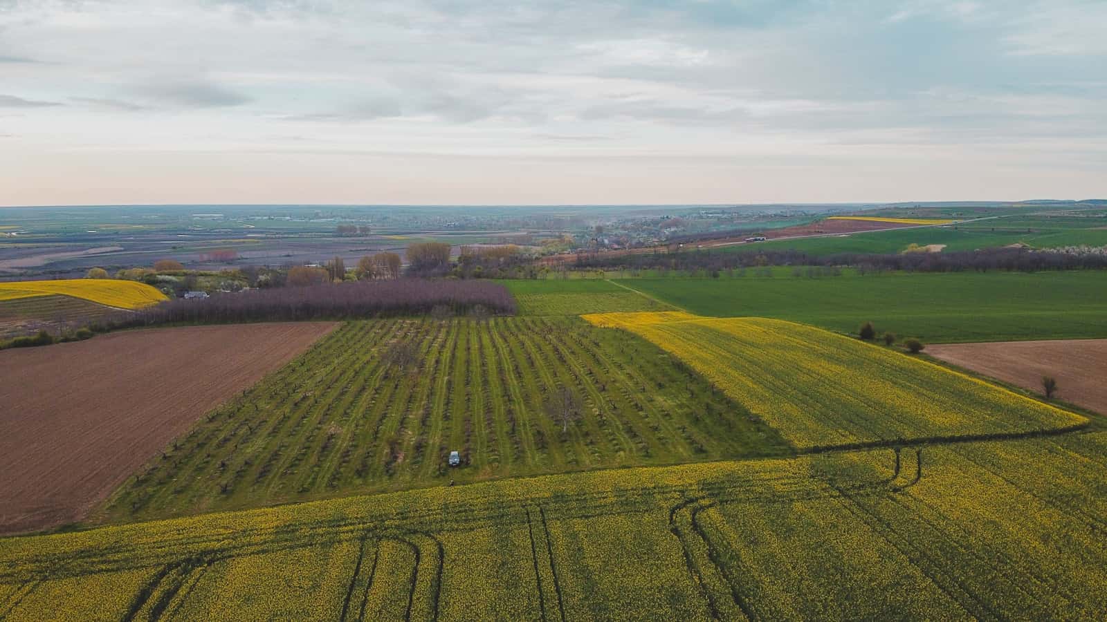
A new perspective on European land
Open a cadastral parcel in any of 16 European countries and see its terrain, solar yield, road and grid distance, land cover and Natura 2000, each with its source.
Check a parcel for free1 without an account, 3 more with one
Open a parcel and see the plan zone where it is published, road, power line, Natura 2000, terrain and sun, with source and date. Pro adds the full analysis, land search and reports.
Background: farm fields from above, Romania · photo Árpád Czapp, Unsplash
Checking country coverage…
What you get
The core set works across Europe; national sources add more where a country publishes them. Every fact shows its source.
Parcel outlines on the map in the countries listed above; in 16 of them a parcel opens with its official reference and area.
Elevation and slope from a digital elevation model.
Expected yield in kWh per kWp from the EU's PVGIS.
Distance to the nearest mapped road, power line and river or lake from OpenStreetMap.
CORINE land cover at the parcel; on the map, parcels coloured by Copernicus land cover.
Protected habitat and bird sites across the 27 EU member states.
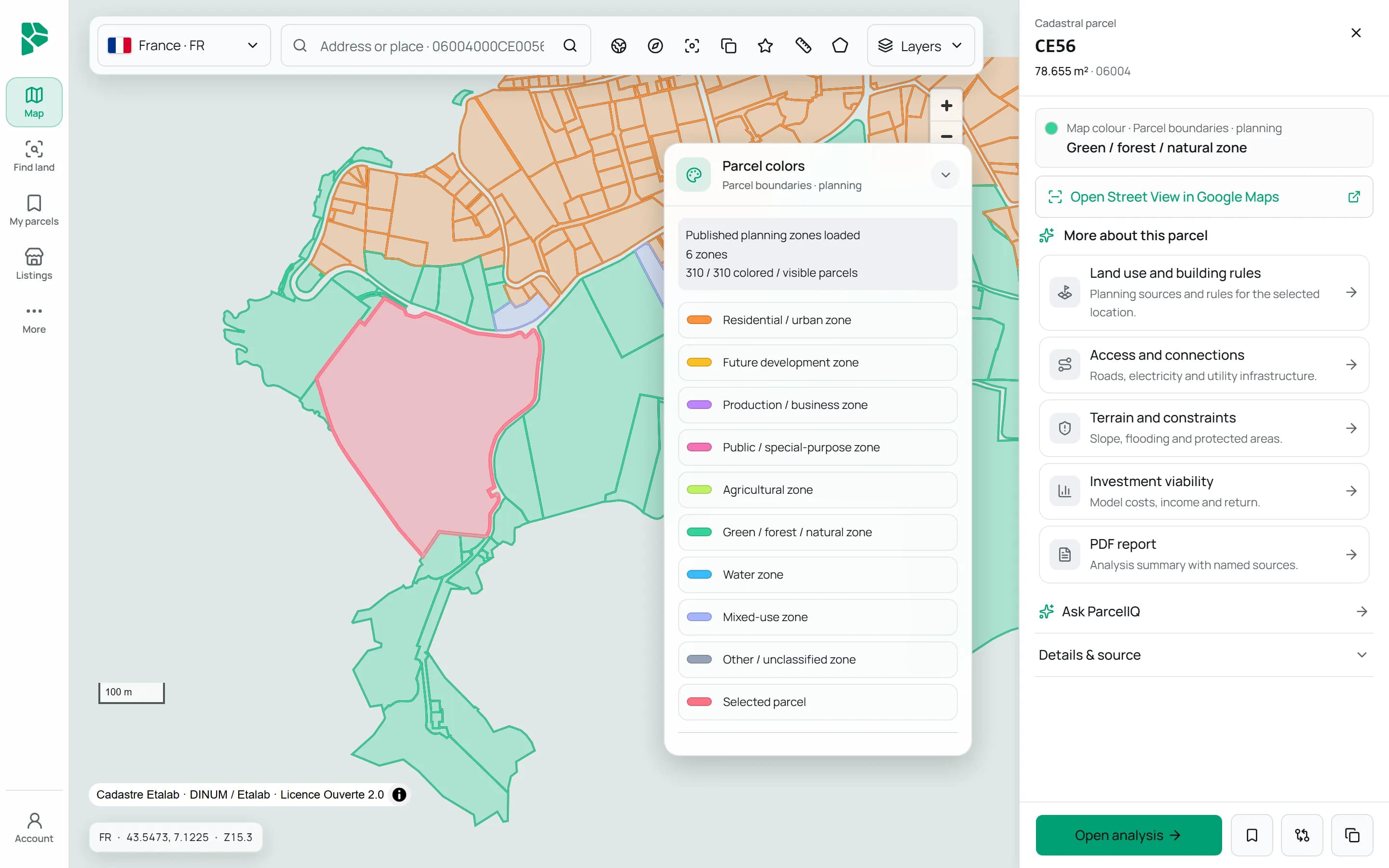
Zoning overlays on the map in 26 countries; in France and Slovenia, the plan zone at the parcel.
Floods in Belgium and Czechia, building registers in France, the Netherlands, Switzerland and Poland, restrictions in Estonia, Lithuania and Liechtenstein, landslides in Italy and the land-use plan in Luxembourg.
Buildings and everyday amenities nearby from OpenStreetMap.
Buildability, ownership and grid capacity are not published in one form across Europe, so the map does not claim them.
Inside the app
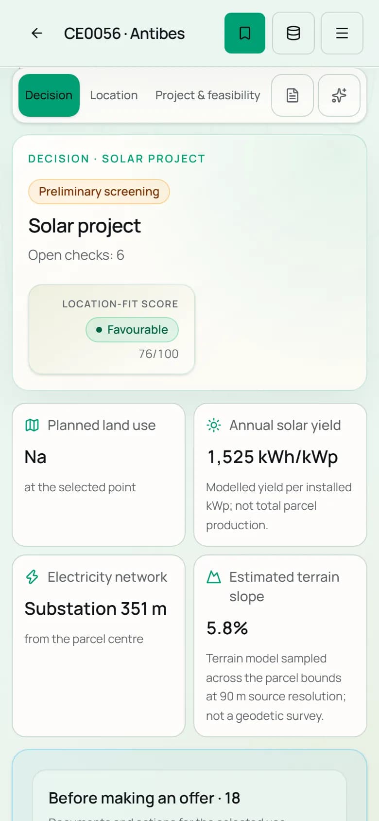
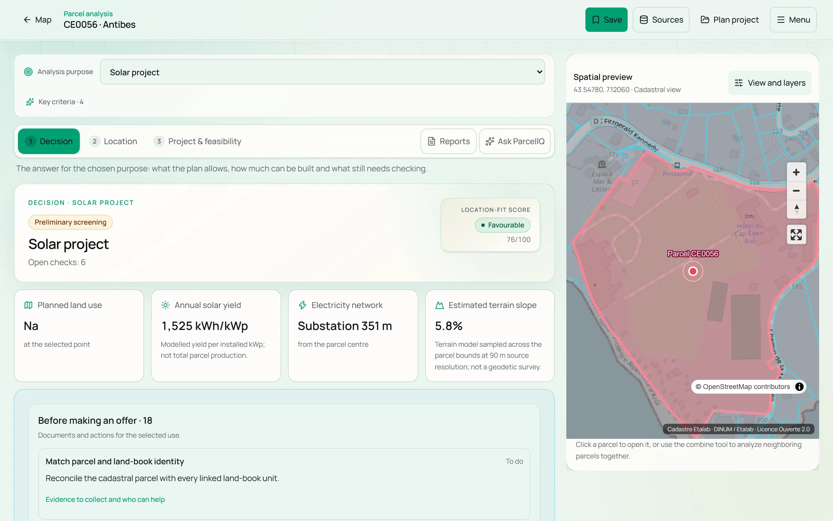
Terrain, sun, access, land cover, Natura 2000 and national sources for one parcel, each with its source and date.
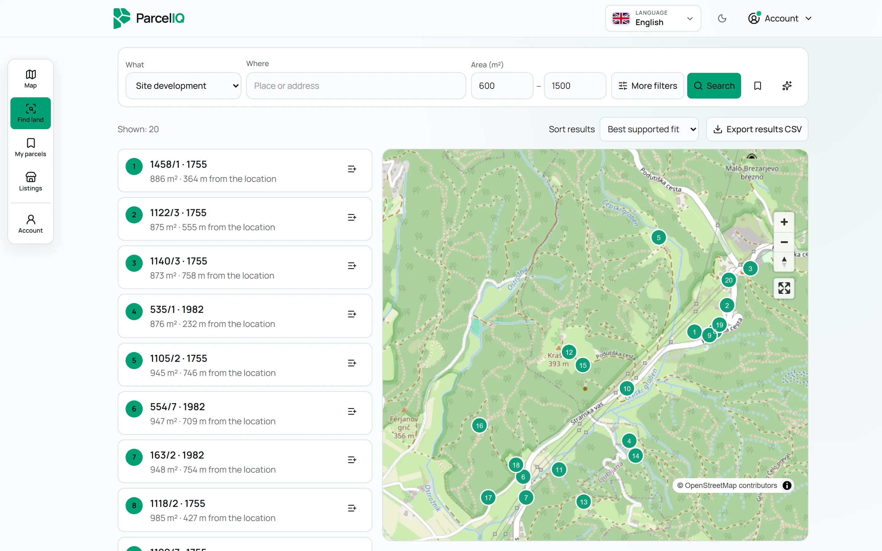
Pick one of 16 purposes, a place and a size, then add criteria. You get parcels on a map, whether or not they are for sale.
A real parcel. A clearer starting point.
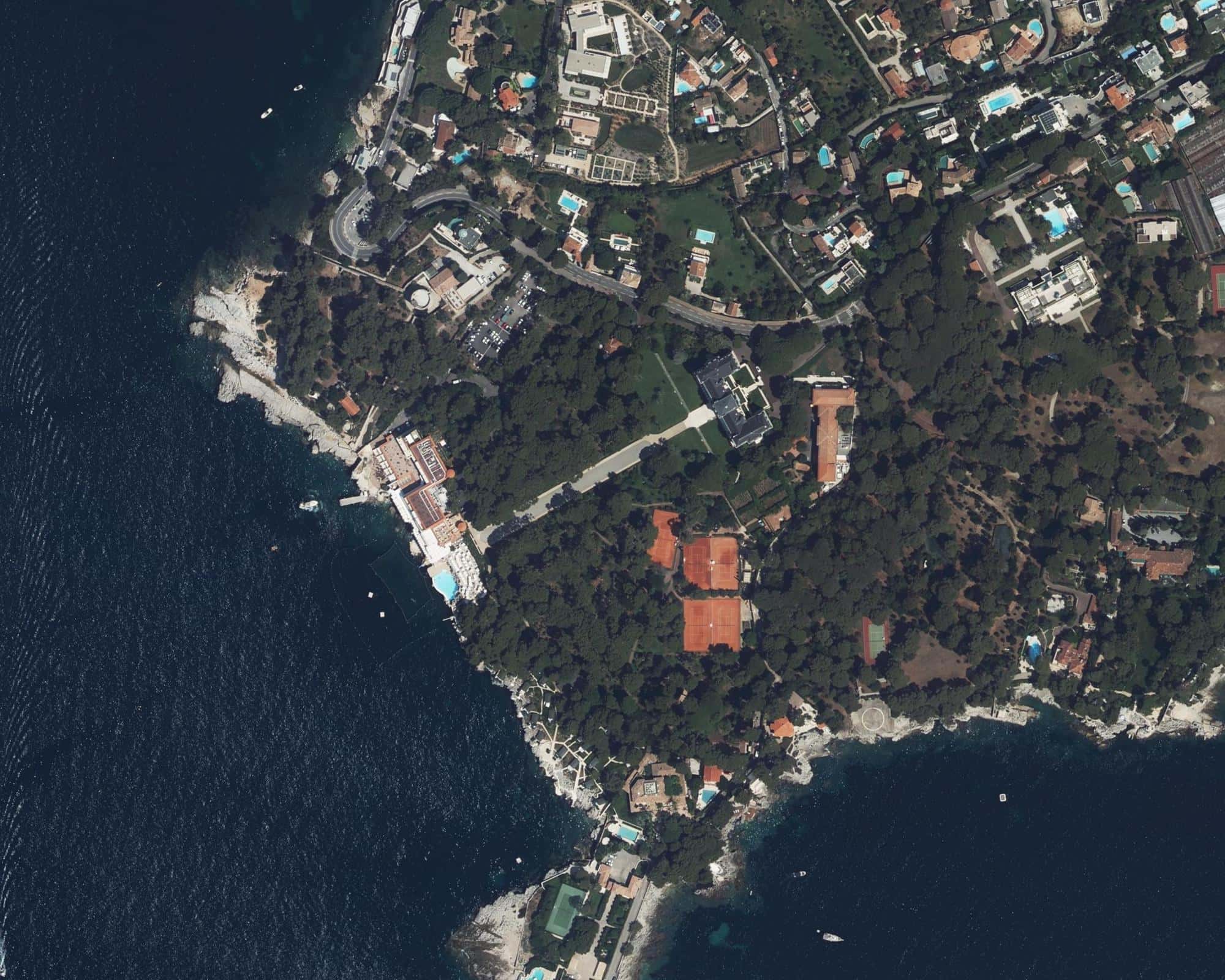
A real coastal parcel in Antibes, southern France. The boundary and registered area come from IGN API Carto (PCI).
Source snapshot: 5 September 2026. IGN BD ORTHO imagery; image acquisition date has not been verified. Not a survey.
This is a cadastral record, not proof of ownership, planning permission or development potential.
Animated aerial view, not a 3D terrain model.
Destination context: official Antibes Juan-les-Pins tourism office. Parcel location: IGN cadastral geometry and orthophoto. This is not a parcel tourism designation, a hotel valuation or proof of development rights.
From a place to a plan
A beautiful location raises questions. ParcelIQ helps you organise the answers, understand what is available and see what needs a closer look.
01 / Buying land
Explore the parcel, review available constraints and keep your next checks together.
Buying land02 / Developing a site
Compare terrain, environmental context and available infrastructure information.
Developing a site03 / Advising a client
Save parcels, compare findings and prepare a traceable report.
Advising a clientParcelIQ Intelligence
Sources, dates and coverage matter. Explore what is connected before relying on an individual finding.
Explore the source catalogueWork your way
Discuss research, site capture and the next steps in a land purchase.
Explore servicesDiscuss a local portal, data integration or a focused pilot.
Become a partnerParcelIQ / Croatia
For Croatian parcels ParcelIQ goes further: plan zones and building rules, the land register, official reference prices and more than 200 kinds of facts per parcel.
The free check: one parcel without an account and 3 more with a free account, with the plan zone where published, road, power line, Natura 2000, terrain and sun. The map, parcel analysis, land search and reports are in the Pro and Team plans, with a free 7-day trial.
Parcel outlines are on the map in the countries listed above, and in 16 of them a parcel opens with its official reference and area. Each country’s page in Data & coverage lists its sources and dates.
Terrain, solar yield, distance to roads, power lines and rivers, land cover and Natura 2000 work across Europe. Plans and national sources add more where a country publishes them. Every fact shows its source.
No. Outside Croatia, buildability, ownership and grid capacity are not published in one form, so ParcelIQ does not state them. Use the plan and land register of the country concerned.
Check a parcel for free, or request a 7-day trial with your company details. Once we approve it, the map, parcel analysis, land search and reports open.
ParcelIQ / Europe
Start with the map. Follow the evidence.